
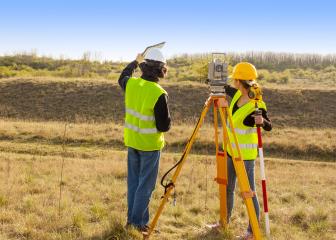
Geodetic Surveyors
Does this career fit your work personality?
Begin The Career Assessment Test- Best Fitting Careers
- Work Personality Strengths
- Work Style Preferences
- and more
Job Outlook
Employment of surveyors is projected to grow 5 percent from 2022 to 2032, faster than the average for all occupations.
About 3,500 openings for surveyors are projected each year, on average, over the decade. Many of those openings are expected to result from the need to replace workers who transfer to different occupations or exit the labor force, such as to retire.
Education Details
Summary of What they do:
Measure large areas of the Earth's surface using satellite observations, global navigation satellite systems (GNSS), light detection and ranging (LIDAR), or related sources.
What Surveyors Do
Surveyors make precise measurements to determine property boundaries. They provide data relevant to the shape and contour of the Earth’s surface for engineering, mapmaking, and construction projects.
Duties

Surveyors typically do the following:
- Measure distances and angles between points on, above, and below the Earth’s surface
- Travel to locations and use known reference points to determine the exact location of important features
- Research land records, survey records, and land titles
- Look for evidence of previous boundaries to determine where boundary lines are located
- Record the results of surveying and verify the accuracy of data
- Prepare plots, maps, and reports
- Present findings to clients and government agencies
- Establish official land and water boundaries for deeds, leases, and other legal documents and testify in court regarding survey work
Surveyors mark and document the location of legal property lines. For example, when a house or commercial building is bought or sold, surveyors may mark property boundaries to prevent or resolve disputes. They use a variety of measuring equipment depending upon the type of survey.
When taking measurements in the field, surveyors make use of the Global Positioning System (GPS), a system of satellites that locates reference points with a high degree of precision. Surveyors use handheld GPS units and automated systems known as robotic total stations to collect relevant information about the terrain they are surveying. Surveyors then interpret and verify the results on a computer.
Surveyors also use Geographic Information Systems (GIS)—technology that allows surveyors to present spatial information visually as maps, reports, and charts. For example, a surveyor can overlay aerial or satellite images with GIS data, such as tree density in a given region, and create digital maps. They then use the results to advise governments and businesses on where to plan homes, roads, and landfills.
Although advances in surveying technology now allow many jobs to be performed by just one surveyor, other jobs may be performed by a crew, consisting of a licensed surveyor and trained surveying technicians. The person in charge of the crew, known as the party chief, may be either a surveyor or a senior surveying technician. The party chief leads day-to-day work activities.
Surveyors also work with civil engineers, landscape architects, cartographers and photogrammetrists, and urban and regional planners to develop comprehensive design documents.
The following are examples of types of surveyors:
Boundary or land surveyors determine the legal property lines and help determine the exact locations of real estate and construction projects.
Engineering or construction surveyors determine the precise location of roads or buildings and proper depths for building foundations. They show changes to the property line and indicate potential restrictions on the property, such as what can be built on it and how large the structure can be. They also may survey the grade and topography of roads.
Forensic surveyors survey and record accident scenes for potential landscape effects.
Geodetic surveyors use high-accuracy technology, including aerial and satellite observations, to measure large areas of the Earth’s surface.
Marine or hydrographic surveyors survey harbors, rivers, and other bodies of water to determine shorelines, the topography of the floor, water depth, and other features.
Mine surveyors survey and map the tunnels in an underground mine. They survey surface mines to determine the volume of materials mined.
Important Qualities
Communication skills. Surveyors must provide clear instructions to team members, clients, and government officials. They also must be able to follow instructions from architects and construction managers, and explain the job’s progress to developers, lawyers, financiers, and government authorities.
Detail oriented. Surveyors must work with precision and accuracy because they produce legally binding documents.
Physical stamina. Surveyors traditionally work outdoors, often in rugged terrain. They must be able to walk long distances and for long periods.
Problem-solving skills. Surveyors must figure out discrepancies between documents showing property lines and current conditions on the land. If there were changes in previous years, they must discover the reason behind them and reestablish property lines.
Time-management skills. Surveyors must be able to effectively plan their time and their team members’ time on the job. This is critical when pressing deadlines exist or while working outside during winter months when daylight hours are short.
Visualization skills. Surveyors must be able to envision new buildings and altered terrain.
Tasks On The Job
- Analyze control or survey data to ensure adherence to project specifications or land survey standards.
- Assess the quality of control data to determine the need for additional survey data for engineering, construction, or other projects.
- Calculate the exact horizontal and vertical position of points on the Earth's surface.
- Compute horizontal and vertical coordinates of control networks, using direct leveling or other geodetic survey techniques, such as triangulation, trilateration, and traversing, to establish features of the Earth's surface.
- Compute, retrace, or adjust existing surveys of features such as highway alignments, property boundaries, utilities, control and other surveys to match the ground elevation-dependent grids, geodetic grids, or property boundaries and to ensure accuracy and continuity of data used in engineering, surveying, or construction projects.
- Conduct surveys to determine exact positions, measurement of points, elevations, lines, areas, volumes, contours, or other features of land surfaces.
- Determine orientation of tracts of land, including position, boundaries, size, and shape, using theodolites, electronic distance-measuring equipment, satellite-based positioning equipment, land information systems, or other geodetic survey equipment.
- Distribute compiled geodetic data to government agencies or the general public.
- Maintain databases of geodetic and related information, including coordinate, descriptive, or quality assurance data.
- Plan or direct the work of geodetic surveying staff, providing technical consultation as needed.
- Prepare progress or technical reports.
- Provide training and interpretation in the use of methods or procedures for observing and checking controls for geodetic and plane coordinates.
- Read current literature, talk with colleagues, continue education, or participate in professional organizations or conferences to keep abreast of developments in technology, equipment, or systems.
- Request additional survey data when field collection errors occur or engineering surveying specifications are not maintained.
- Review existing standards, controls, or equipment used, recommending changes or upgrades as needed.
- Verify the mathematical correctness of newly collected survey data.

PERSONALITY
| Your Assessment Results |
CAREER CHARACTERISTICS
Importance
|
|---|
|
?
? ? ?
|
92% | Attention to Detail - Job requires being careful about detail and thorough in completing work tasks. | |
|
?
? ? ?
|
87% | Integrity - Job requires being honest and ethical. | |
|
?
? ? ?
|
81% | Analytical Thinking - Job requires analyzing information and using logic to address work-related issues and problems. | |
|
?
? ? ?
|
80% | Dependability - Job requires being reliable, responsible, and dependable, and fulfilling obligations. | |
|
?
? ? ?
|
71% | Cooperation - Job requires being pleasant with others on the job and displaying a good-natured, cooperative attitude. | |
|
?
? ? ?
|
70% | Persistence - Job requires persistence in the face of obstacles. | |
|
?
? ? ?
|
69% | Adaptability/Flexibility - Job requires being open to change (positive or negative) and to considerable variety in the workplace. | |
|
?
? ? ?
|
68% | Independence - Job requires developing one's own ways of doing things, guiding oneself with little or no supervision, and depending on oneself to get things done. | |
|
?
? ? ?
|
68% | Initiative - Job requires a willingness to take on responsibilities and challenges. | |
|
?
? ? ?
|
61% | Achievement/Effort - Job requires establishing and maintaining personally challenging achievement goals and exerting effort toward mastering tasks. | |
|
?
? ? ?
|
59% | Self-Control - Job requires maintaining composure, keeping emotions in check, controlling anger, and avoiding aggressive behavior, even in very difficult situations. | |
|
?
? ? ?
|
58% | Stress Tolerance - Job requires accepting criticism and dealing calmly and effectively with high-stress situations. | |
|
?
? ? ?
|
56% | Innovation - Job requires creativity and alternative thinking to develop new ideas for and answers to work-related problems. | |
|
?
? ? ?
|
56% | Leadership - Job requires a willingness to lead, take charge, and offer opinions and direction. | |
|
?
? ? ?
|
53% | Concern for Others - Job requires being sensitive to others' needs and feelings and being understanding and helpful on the job. | |
| Your Assessment Results |
IMPORTANT STRENGTHS
Importance
|
|---|
|
?
? ? ?
|
67% | Investigative - Work involves studying and researching non-living objects, living organisms, disease or other forms of impairment, or human behavior. Investigative occupations are often associated with physical, life, medical, or social sciences, and can be found in the fields of humanities, mathematics/statistics, information technology, or health care service. | |
|
?
? ? ?
|
67% | Conventional - Work involves following procedures and regulations to organize information or data, typically in a business setting. Conventional occupations are often associated with office work, accounting, mathematics/statistics, information technology, finance, or human resources. | |
|
?
? ? ?
|
56% | Realistic - Work involves designing, building, or repairing of equipment, materials, or structures, engaging in physical activity, or working outdoors. Realistic occupations are often associated with engineering, mechanics and electronics, construction, woodworking, transportation, machine operation, agriculture, animal services, physical or manual labor, athletics, or protective services. | |
| Your Assessment Results |
WORK VALUES
Importance
|
|---|
|
?
? ? ?
|
61% | Achievement - Occupations that satisfy this work value are results oriented and allow employees to use their strongest abilities, giving them a feeling of accomplishment. Corresponding needs are Ability Utilization and Achievement. | |
|
?
? ? ?
|
56% | Working Conditions - Occupations that satisfy this work value offer job security and good working conditions. Corresponding needs are Activity, Compensation, Independence, Security, Variety and Working Conditions. | |
|
?
? ? ?
|
56% | Support - Occupations that satisfy this work value offer supportive management that stands behind employees. Corresponding needs are Company Policies, Supervision: Human Relations and Supervision: Technical. | |
|
?
? ? ?
|
56% | Independence - Occupations that satisfy this work value allow employees to work on their own and make decisions. Corresponding needs are Creativity, Responsibility and Autonomy. | |
APTITUDES
| Your Assessment Results |
ABILITIES | SKILLS
Importance
|
|---|
|
?
? ? ?
|
75% | Oral Comprehension - The ability to listen to and understand information and ideas presented through spoken words and sentences. | |
|
?
? ? ?
|
75% | Written Comprehension - The ability to read and understand information and ideas presented in writing. | |
|
?
? ? ?
|
75% | Oral Expression - The ability to communicate information and ideas in speaking so others will understand. | |
|
?
? ? ?
|
75% | Written Expression - The ability to communicate information and ideas in writing so others will understand. | |
|
?
? ? ?
|
75% | Inductive Reasoning - The ability to combine pieces of information to form general rules or conclusions (includes finding a relationship among seemingly unrelated events). | |
|
?
? ? ?
|
75% | Information Ordering - The ability to arrange things or actions in a certain order or pattern according to a specific rule or set of rules (e.g., patterns of numbers, letters, words, pictures, mathematical operations). | |
|
?
? ? ?
|
75% | Mathematical Reasoning - The ability to choose the right mathematical methods or formulas to solve a problem. | |
|
?
? ? ?
|
75% | Flexibility of Closure - The ability to identify or detect a known pattern (a figure, object, word, or sound) that is hidden in other distracting material. | |
|
?
? ? ?
|
72% | Deductive Reasoning - The ability to apply general rules to specific problems to produce answers that make sense. | |
|
?
? ? ?
|
72% | Number Facility - The ability to add, subtract, multiply, or divide quickly and correctly. | |
|
?
? ? ?
|
72% | Near Vision - The ability to see details at close range (within a few feet of the observer). | |
|
?
? ? ?
|
70% | Mathematics - Using mathematics to solve problems. | |
|
?
? ? ?
|
69% | Category Flexibility - The ability to generate or use different sets of rules for combining or grouping things in different ways. | |
|
?
? ? ?
|
63% | Problem Sensitivity - The ability to tell when something is wrong or is likely to go wrong. It does not involve solving the problem, only recognizing that there is a problem. | |
|
?
? ? ?
|
63% | Reading Comprehension - Understanding written sentences and paragraphs in work-related documents. | |
|
?
? ? ?
|
59% | Writing - Communicating effectively in writing as appropriate for the needs of the audience. | |
|
?
? ? ?
|
59% | Critical Thinking - Using logic and reasoning to identify the strengths and weaknesses of alternative solutions, conclusions, or approaches to problems. | |
|
?
? ? ?
|
59% | Active Learning - Understanding the implications of new information for both current and future problem-solving and decision-making. | |
|
?
? ? ?
|
57% | Active Listening - Giving full attention to what other people are saying, taking time to understand the points being made, asking questions as appropriate, and not interrupting at inappropriate times. | |
|
?
? ? ?
|
56% | Visualization - The ability to imagine how something will look after it is moved around or when its parts are moved or rearranged. | |
|
?
? ? ?
|
55% | Speaking - Talking to others to convey information effectively. | |
|
?
? ? ?
|
55% | Monitoring - Monitoring/Assessing performance of yourself, other individuals, or organizations to make improvements or take corrective action. | |
|
?
? ? ?
|
55% | Complex Problem Solving - Identifying complex problems and reviewing related information to develop and evaluate options and implement solutions. | |
|
?
? ? ?
|
54% | Judgment and Decision Making - Considering the relative costs and benefits of potential actions to choose the most appropriate one. | |
|
?
? ? ?
|
53% | Fluency of Ideas - The ability to come up with a number of ideas about a topic (the number of ideas is important, not their quality, correctness, or creativity). | |
|
?
? ? ?
|
53% | Speech Clarity - The ability to speak clearly so others can understand you. | |
| Your Assessment Results |
TASKS | ACTIVITIES
Importance
|
|---|
|
?
? ? ?
|
91% | Working with Computers - Using computers and computer systems (including hardware and software) to program, write software, set up functions, enter data, or process information. | |
|
?
? ? ?
|
90% | Processing Information - Compiling, coding, categorizing, calculating, tabulating, auditing, or verifying information or data. | |
|
?
? ? ?
|
87% | Getting Information - Observing, receiving, and otherwise obtaining information from all relevant sources. | |
|
?
? ? ?
|
87% | Analyzing Data or Information - Identifying the underlying principles, reasons, or facts of information by breaking down information or data into separate parts. | |
|
?
? ? ?
|
83% | Documenting/Recording Information - Entering, transcribing, recording, storing, or maintaining information in written or electronic/magnetic form. | |
|
?
? ? ?
|
81% | Evaluating Information to Determine Compliance with Standards - Using relevant information and individual judgment to determine whether events or processes comply with laws, regulations, or standards. | |
|
?
? ? ?
|
81% | Updating and Using Relevant Knowledge - Keeping up-to-date technically and applying new knowledge to your job. | |
|
?
? ? ?
|
80% | Making Decisions and Solving Problems - Analyzing information and evaluating results to choose the best solution and solve problems. | |
|
?
? ? ?
|
75% | Identifying Objects, Actions, and Events - Identifying information by categorizing, estimating, recognizing differences or similarities, and detecting changes in circumstances or events. | |
|
?
? ? ?
|
71% | Communicating with Supervisors, Peers, or Subordinates - Providing information to supervisors, co-workers, and subordinates by telephone, in written form, e-mail, or in person. | |
|
?
? ? ?
|
68% | Communicating with People Outside the Organization - Communicating with people outside the organization, representing the organization to customers, the public, government, and other external sources. This information can be exchanged in person, in writing, or by telephone or e-mail. | |
|
?
? ? ?
|
67% | Interpreting the Meaning of Information for Others - Translating or explaining what information means and how it can be used. | |
|
?
? ? ?
|
67% | Monitoring Processes, Materials, or Surroundings - Monitoring and reviewing information from materials, events, or the environment, to detect or assess problems. | |
|
?
? ? ?
|
66% | Estimating the Quantifiable Characteristics of Products, Events, or Information - Estimating sizes, distances, and quantities; or determining time, costs, resources, or materials needed to perform a work activity. | |
|
?
? ? ?
|
65% | Organizing, Planning, and Prioritizing Work - Developing specific goals and plans to prioritize, organize, and accomplish your work. | |
|
?
? ? ?
|
63% | Scheduling Work and Activities - Scheduling events, programs, and activities, as well as the work of others. | |
|
?
? ? ?
|
60% | Thinking Creatively - Developing, designing, or creating new applications, ideas, relationships, systems, or products, including artistic contributions. | |
|
?
? ? ?
|
59% | Providing Consultation and Advice to Others - Providing guidance and expert advice to management or other groups on technical, systems-, or process-related topics. | |
|
?
? ? ?
|
57% | Inspecting Equipment, Structures, or Materials - Inspecting equipment, structures, or materials to identify the cause of errors or other problems or defects. | |
|
?
? ? ?
|
57% | Training and Teaching Others - Identifying the educational needs of others, developing formal educational or training programs or classes, and teaching or instructing others. | |
|
?
? ? ?
|
56% | Establishing and Maintaining Interpersonal Relationships - Developing constructive and cooperative working relationships with others, and maintaining them over time. | |
|
?
? ? ?
|
56% | Performing General Physical Activities - Performing physical activities that require considerable use of your arms and legs and moving your whole body, such as climbing, lifting, balancing, walking, stooping, and handling materials. | |
|
?
? ? ?
|
55% | Judging the Qualities of Objects, Services, or People - Assessing the value, importance, or quality of things or people. | |
|
?
? ? ?
|
54% | Developing Objectives and Strategies - Establishing long-range objectives and specifying the strategies and actions to achieve them. | |
|
?
? ? ?
|
51% | Controlling Machines and Processes - Using either control mechanisms or direct physical activity to operate machines or processes (not including computers or vehicles). | |
|
?
? ? ?
|
51% | Coordinating the Work and Activities of Others - Getting members of a group to work together to accomplish tasks. | |
|
?
? ? ?
|
51% | Drafting, Laying Out, and Specifying Technical Devices, Parts, and Equipment - Providing documentation, detailed instructions, drawings, or specifications to tell others about how devices, parts, equipment, or structures are to be fabricated, constructed, assembled, modified, maintained, or used. | |
| Your Assessment Results |
CONTEXT | ATTRIBUTES
Importance
|
|---|
|
?
? ? ?
|
98% | Electronic Mail - How often do you use electronic mail in this job? | |
|
?
? ? ?
|
96% | Importance of Being Exact or Accurate - How important is being very exact or highly accurate in performing this job? | |
|
?
? ? ?
|
87% | Telephone - How often do you have telephone conversations in this job? | |
|
?
? ? ?
|
83% | Face-to-Face Discussions - How often do you have to have face-to-face discussions with individuals or teams in this job? | |
|
?
? ? ?
|
78% | Freedom to Make Decisions - How much decision making freedom, without supervision, does the job offer? | |
|
?
? ? ?
|
75% | Indoors, Environmentally Controlled - How often does this job require working indoors in environmentally controlled conditions? | |
|
?
? ? ?
|
74% | Work With Work Group or Team - How important is it to work with others in a group or team in this job? | |
|
?
? ? ?
|
71% | Structured versus Unstructured Work - To what extent is this job structured for the worker, rather than allowing the worker to determine tasks, priorities, and goals? | |
|
?
? ? ?
|
70% | Contact With Others - How much does this job require the worker to be in contact with others (face-to-face, by telephone, or otherwise) in order to perform it? | |
|
?
? ? ?
|
69% | Outdoors, Exposed to Weather - How often does this job require working outdoors, exposed to all weather conditions? | |
|
?
? ? ?
|
64% | In an Enclosed Vehicle or Equipment - How often does this job require working in a closed vehicle or equipment (e.g., car)? | |
|
?
? ? ?
|
59% | Deal With External Customers - How important is it to work with external customers or the public in this job? | |
|
?
? ? ?
|
58% | Frequency of Decision Making - How frequently is the worker required to make decisions that affect other people, the financial resources, and/or the image and reputation of the organization? | |
|
?
? ? ?
|
58% | Letters and Memos - How often does the job require written letters and memos? | |
|
?
? ? ?
|
58% | Coordinate or Lead Others - How important is it to coordinate or lead others in accomplishing work activities in this job? | |
|
?
? ? ?
|
58% | Indoors, Not Environmentally Controlled - How often does this job require working indoors in non-controlled environmental conditions (e.g., warehouse without heat)? | |
|
?
? ? ?
|
57% | Impact of Decisions on Co-workers or Company Results - What results do your decisions usually have on other people or the image or reputation or financial resources of your employer? | |
|
?
? ? ?
|
57% | Spend Time Using Your Hands to Handle, Control, or Feel Objects, Tools, or Controls - How much does this job require using your hands to handle, control, or feel objects, tools or controls? | |
|
?
? ? ?
|
56% | Time Pressure - How often does this job require the worker to meet strict deadlines? | |
|
?
? ? ?
|
55% | Importance of Repeating Same Tasks - How important is repeating the same physical activities (e.g., key entry) or mental activities (e.g., checking entries in a ledger) over and over, without stopping, to performing this job? | |
|
?
? ? ?
|
53% | Wear Common Protective or Safety Equipment such as Safety Shoes, Glasses, Gloves, Hearing Protection, Hard Hats, or Life Jackets - How much does this job require wearing common protective or safety equipment such as safety shoes, glasses, gloves, hard hats or life jackets? | |
|
?
? ? ?
|
52% | Responsible for Others' Health and Safety - How much responsibility is there for the health and safety of others in this job? | |
|
?
? ? ?
|
51% | Spend Time Sitting - How much does this job require sitting? | |
|
?
? ? ?
|
76% | Duration of Typical Work Week - Number of hours typically worked in one week. | |
Work Environment

Surveyors held about 50,800 jobs in 2022. The largest employers of surveyors were as follows:
| Architectural, engineering, and related services | 70% |
| Government | 8 |
| Construction | 7 |
| Self-employed workers | 4 |
| Mining, quarrying, and oil and gas extraction | 1 |
Depending on the specific job duties, surveying involves both fieldwork and office work. Fieldwork involves working outdoors in all types of weather, walking long distances, and standing for extended periods while taking measurements. Surveyors sometimes climb hills with heavy packs of surveying instruments. When working near hazards such as traffic, surveyors generally wear brightly colored or reflective vests so they may be seen more easily. When working in underground mines, surveyors work in enclosed spaces.
Traveling is often part of the job, and surveyors may commute long distances or stay at a project location for an extended period of time. Those who work on resource extraction projects may work in remote areas and spend long periods away from home.
Work Schedules
Surveyors usually work full time. When construction activity is high, they may work more hours than usual.
Getting Started
How to Become a Surveyor
Surveyors typically need a bachelor’s degree. They must be licensed before they can certify legal documents and provide surveying services to the public.
Education
Surveyors typically need a bachelor’s degree. Some colleges and universities offer programs that prepare students to become licensed surveyors. A bachelor’s degree in a related field, such as engineering or natural resources, may be acceptable as well. Many states require individuals who want to become licensed surveyors to have a bachelor’s degree from a school accredited by an organization such as ABET.
In some cases, employers may hire candidates who have an associate’s degree and additional training.
Training
In order to become licensed, most states require approximately 4 years of work experience and training under a licensed surveyor after obtaining a bachelor’s degree. Other states may allow substituting more years of work experience and supervised training under a licensed surveyor in place of education.
Work Experience in a Related Occupation
In some states, surveying technicians can become licensed surveyors after working for as many as 10 years under a licensed surveyor. The amount of work experience required varies by state. Check with your state for more information.
Licenses, Certifications, and Registrations
All 50 states and the District of Columbia require surveyors to be licensed before they can certify legal documents that show property lines or determine proper markings on construction projects. Candidates with a bachelor’s degree usually must work for several years under the direction of a licensed surveyor in order to qualify for licensure.
Although the process of obtaining a license varies by state, the National Council of Examiners for Engineering and Surveying has a generalized process of four steps:
-
- Complete the level of education required in your state
- Pass the Fundamentals of Surveying (FS) exam
- Gain sufficient work experience under a licensed surveyor
- Pass the Principles and Practice of Surveying (PS) exam
Most states also have continuing education requirements for surveyors to maintain their license.
Contacts for More Information
For information about surveying, career opportunities, and licensure requirements, visit
National Council of Examiners for Engineering and Surveying
National Society of Professional Surveyors
For information about a career as a geodetic surveyor, visit
American Association for Geodetic Surveying
For a list of schools offering accredited programs, visit
Similar Occupations
This table shows a list of occupations with job duties that are similar to those of surveyors.
| Occupation | Job Duties | Entry-Level Education | Median Annual Pay, May 2022 | |
|---|---|---|---|---|

|
Cartographers and Photogrammetrists |
Cartographers and photogrammetrists collect, measure, and interpret geographic information in order to create and update maps and charts for regional planning, education, and other purposes. |
Bachelor's degree | $71,890 |

|
Civil Engineers |
Civil engineers plan, design, and supervise the construction and maintenance of building and infrastructure projects. |
Bachelor's degree | $89,940 |

|
Civil Engineering Technologists and Technicians |
Civil engineering technologists and technicians help civil engineers plan, design, and build infrastructure and development projects. |
Associate's degree | $59,630 |

|
Construction and Building Inspectors |
Construction and building inspectors ensure that construction meets building codes and ordinances, zoning regulations, and contract specifications. |
High school diploma or equivalent | $64,480 |

|
Drafters |
Drafters use software to convert the designs of engineers and architects into technical drawings. |
Associate's degree | $60,400 |

|
Geographers |
Geographers study the Earth and the distribution of its land, features, and inhabitants. |
Bachelor's degree | $88,900 |

|
Hydrologists |
Hydrologists study how water moves across and through the Earth’s crust. |
Bachelor's degree | $85,990 |

|
Landscape Architects |
Landscape architects design parks and other outdoor spaces. |
Bachelor's degree | $73,210 |

|
Surveying and Mapping Technicians |
Surveying and mapping technicians collect data and make maps of the Earth's surface. |
High school diploma or equivalent | $47,180 |

|
Urban and Regional Planners |
Urban and regional planners develop land use plans and programs that help create communities, accommodate population growth, and revitalize physical facilities. |
Master's degree | $79,540 |